
|
This 2002 photo shows the northbound New Jersey Turnpike (I-95) just past EXIT 14 (I-78 / Newark Airport) in Newark. Just ahead is the split for the eastern and western spurs of the turnpike. (Photo by Jim K. Georges.) |
||

|
THE NEED FOR A MODERN LINK IN THE NORTHEAST CORRIDOR: From colonial times, the corridor between New York and Philadelphia - indeed, the corridor along the entire eastern seaboard - has been heavily traveled first by stagecoach, and later by motor vehicles. This corridor placed New Jersey as the key link in the East Coast travel chain. With the introduction of automobiles, this corridor took on even greater importance. |
||
|
By the 1930's, US 1 (and south of New Brunswick, US 130), which passed through small towns and large cities alike, had been so choked with traffic that the state of New Jersey considered the construction of a superhighway along this corridor. In response, proposals were developed to construct a 12-lane superhighway from Boston to Washington. The sketches showed a road with six carriageways, each carrying two lanes for express, local and service (frontage) traffic. The restricted budgets of the Great Depression and the outbreak of World War II delayed the superhighway, originally planned as "FAI Corridor 100," but Governor Alfred E. Driscoll revived the idea for its construction in his January 1947 inaugural address. |
||
|
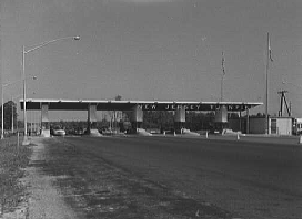
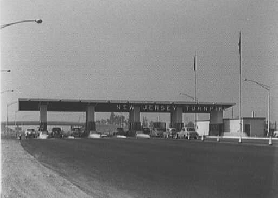
These 1952 photos show the southern (EXIT 1 -- Delaware Memorial Bridge, left photo) and northern (EXIT 18 -- George Washington Bridge, right photo ) termini of the New Jersey Turnpike. (Photos by Library of Congress, Prints and Photographs Division, Gottscho-Schleisner Collection, LC-G613-59270 and LC-G61362098.) |
||
|
DESIGN CRITERIA: Before the New Jersey Turnpike was constructed, the engineers who oversaw the seven simultaneous projects had to adhere to a uniform set of standards. First, the engineers determined that the turnpike should be a controlled-access highway. Access to the turnpike would only be at interchanges that were spaced considerable distances apart. The roadways were to have extra-wide traffic lanes, wide shoulders on both sides of the traffic lanes, and grades and curve radii kept to a minimum. These criteria reflected state-of-the-art thinking in highway design. |
||
|
The engineers started by establishing a design speed, the theoretical standard to which all elements of construction were designed. The design speed was 75 MPH south of East Brunswick (EXIT 9), and 70 MPH north of East Brunswick. As an example, all curves were laid out so that a car traveling at the design speed would have ample sight distance ahead; the lettering on all signs would be legible at the design speed; the shoulder firm enough and the length of the acceleration and deceleration lanes long enough for a moving at the design speed. In the end, the engineers established a legal speed limit of 60 MPH to allow for a margin of safety. |
||
|
To make these speeds possible, the engineers had to build to particular specifications. The 12-foot-wide lanes, which could accommodate all but the widest vehicles, set the standard by which future expressways would be built. The 10-foot-wide shoulders were ample enough for parking disabled cars safely. The 1,200-foot-long acceleration and deceleration lanes, another standard that holds today, enabled motorists to enter and exit the turnpike without interrupting the flow of the main traffic lanes. To provide a safe efficient means of travel between two points, all grades were to be kept to a maximum of three percent, and all curves were to have a minimum radius of 3,000 feet. |
||
|
Particular attention was paid to the signs and visibility along the New Jersey Turnpike. The first signs announcing the interchange, which gives the route and route number, and the towns to which the interchange gives access, are posted two miles prior to the interchange. Such signs are repeated one mile before the interchange, as well as at the interchange. At the interchange, distances to the next interchange are also posted. All signs were to reflect brightly at night, either because of button-copy reflectors set into the letters, or because of the light-reflective plastic letters themselves. Reflectors are also posted above the shoulders at 150-foot intervals, as well as installed in the six-inch-wide broken white lines that separate the traffic lanes. |
||
|
LEFT: Construction crews hurry to finish the Hackensack River bridge on the New Jersey Turnpike in this 1951 photo. RIGHT: Artist's rendition of the turnpike's Passaic River bridge. (Photos by Library of Congress, Prints and Photographs Division, Gottscho-Schleisner Collection, LC-G613-60377 and LC-G613-60374.) |
||
|
CONSTRUCTION OF THE TURNPIKE: Crews broke ground for the construction of the New Jersey Turnpike in January 1950. Few difficulties were encountered during construction of the turnpike in the rolling terrain of southern New Jersey, from the southern terminus in Deepwater Township to the Raritan River in New Brunswick. However, more significant engineering challenges came in northern New Jersey. |
||
|
The city that was most affected by construction of the turnpike was Elizabeth, an older industrial city of 110,000 residents. Plans called for the condemnation of 450 homes in a depressed Elizabeth neighborhood where property values were lowest. Responding to fears that property values would plummet even more and that crime would increase, officials in Elizabeth offered an alternative route along the waterfront. However, the waterfront alternative would have disrupted 32 companies, some of whom threatened to leave New Jersey if this route had been adopted. Ultimately, the Turnpike Authority chose the route through residential Elizabeth, since there was not much leeway between Newark Airport to the west and Elizabeth Seaport to the east. Once in the city, the Turnpike Authority had to construct overpasses and underpasses for local streets, railroad tracks, pipelines and other utilities, an undertaking that significantly added to construction costs. |
||
|
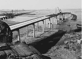
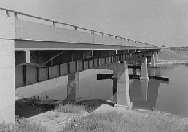
This 1952 photo shows the engineering feat of pushing the New Jersey Turnpike viaduct underneath the arches of the Pulaski Skyway. (Photo by Library of Congress, Prints and Photographs Division, Gottscho-Schleisner Collection, LC-G613-62221.) |
||
|
THE TURNPIKE OPENS TO ACCOLADES: The entire 118-mile length of the New Jersey Turnpike took 25 months to construct, at a total cost of $255 million. The first 44-mile-long stretch, from EXIT 1 in Carneys Point Township north to EXIT 5 in Westampton Township, opened on November 5, 1951. A second 49-mile-long stretch from EXIT 5 north to EXIT 11 in Woodbridge opened on November 30, 1951, followed by a third 16-mile-long stretch from EXIT 11 north to EXIT 15E in Newark on December 20, 1951. The fourth and final nine-mile-long stretch, from EXIT 15E north to EXIT 18 in Ridgefield, opened on January 15, 1952. |
||
|
Upon its completion, Governor Driscoll made the following proclamation in The New York Times: |
||
|
These 1952 photos of the New Jersey Turnpike show an overpass in Woodbridge (left photo) and the Raritan River bridge in New Brunswick (right photo). (Photos by Library of Congress, Prints and Photographs Division, Gottscho-Schleisner Collection, LC-G613-62225 and LC-G613-62074.) |
||
|
THE NEED FOR EXPANSION: When the four-lane New Jersey Turnpike opened in 1952, traffic patterns were forecast such that any expansion to six lanes would not take place until 1975. The traffic demands of the Northeast Corridor necessitated the first turnpike expansion project, an 83-mile-long widening in 1955. The widening project provided the following configurations: |
||
|
In 1966, a second widening project began between EXIT 10 and EXIT 14. This project provided the turnpike's dual-dual roadway system in which passenger cars used the inner roadways, while the outer roadways were open to all vehicles. The widening project brought the number of traffic lanes from eight to twelve. The dual-dual system was extended south to EXIT 9 in East Brunswick in 1973, where the turnpike was widened from six to twelve lanes, and again to EXIT 8A in Monroe Township in 1990, where the turnpike was widened from six to ten lanes. Congestion near the turnpike's northern terminus prompted the Turnpike Authority to construct a "western spur," a 12-mile section that branches off the turnpike mainline in Newark and reconnects to it in Ridgefield Park. The "western spur," which was completed in 1970, carries through traffic between the George Washington Bridge and points south, and accommodates traffic bound for the Meadowlands Sports Complex. The original mainline, now known as the "eastern spur," primarily carries traffic bound for the Lincoln Tunnel. Both "spurs" post signs for I-95. New growth along the turnpike corridor prompted construction of new interchanges. During the mid-1970's, two new interchanges - EXIT 7A (I-195) and EXIT 8A (NJ 32) - opened to traffic. In 1982, EXIT 13A (NJ 81 Freeway) opened to serve Newark Airport and Elizabeth Seaport. In 1990, the New Jersey Turnpike Authority reconstructed EXIT 7 (US 206) in Bordentown to accommodate the growing number of trucks using nearby I-295. Although the $30 million project did not change the route that trucks take between I-295 and the turnpike, it did replace five toll lanes with 12 new ones in a new toll plaza about one-half mile north of the existing plaza. New ramps and bridge were constructed between the turnpike and the relocated plaza. |
||
|
In 1996, the turnpike was widened once again, this time from twelve to fourteen lanes, between EXIT 11 and EXIT 14. An additional lane provided to the outer roadways between these exits is reserved for HOV use during peak hours. The HOV lanes are open to all vehicles in non-peak hours, and in May 2006, hybrid vehicles were permitted to use the lanes during peak periods. The cost of this widening project was $361 million, more than the cost of the original turnpike. |
||

|
One year later, improvements were made on a 1.5-mile stretch between EXIT 14 and EXIT 15E in Newark. This stretch, known as the "mixing bowl" because of the many converging and diverging roadways (i.e., entrance and exit ramps, splits for the inner and outer roadways), experienced high accident rates over the years. The five-year project, which relieved congestion and improved safety, cost $148 million. |
||
|
EXTENDING TO THE GEORGE WASHINGTON BRIDGE: In 1964, following four years of construction, a four-mile-link opened to connect the George Washington Bridge approach in Fort Lee with Interstate 80 (Bergen-Passaic Expressway) in Teaneck. The ten-lane section, which is signed exclusively as I-95, is comprised of local and express lanes in a 3-2-2-3 configuration. Originally planned as a straight-line route from the eastern end of I-80 to the George Washington Bridge, this section was rerouted after borough officials in Leonia filed suit with the New Jersey State Highway Department, citing that the route would run directly through the business district. The borough officials were successful in forcing the present alignment that curves around the northern boundary of Leonia. |
||


|
In 1971, the New Jersey Department of Transportation (NJDOT) opened a one-mile-long I-95 link that connected the New Jersey Turnpike with the I-80 / I-95 interchange in Teaneck. The NJDOT constructed a modified "directional-T" interchange with separate ramps to the local and express lanes on I-80 and I-95. |
||
|
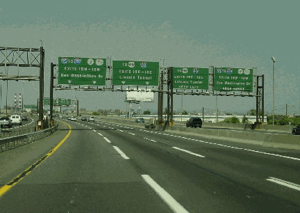
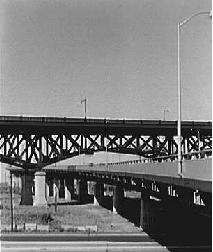
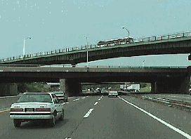
These 1998 photos show the New Jersey Turnpike through industrial North Jersey. LEFT: The turnpike at EXIT 15E (US 1-US 9) in Newark, near the Pulaski Skyway. RIGHT: The turnpike at EXIT 11 (Garden State Parkway) in Woodbridge. (Photos by Jim K. Georges.) |
||
|
THE TURNPIKE TODAY: The New Jersey Turnpike is designated I-95 from EXIT 6 (Pennsylvania Turnpike Extension) to the George Washington Bridge toll plaza. Until recently, the I-95 designation only went as far south as EXIT 10. Originally, the state of New Jersey planned to construct a 29-mile stretch of I-95, from I-287 in Middlesex County south to Mercer County, on a route parallel to US 1 and the New Jersey Turnpike The proposed I-95 "missing link" through central New Jersey was abandoned in the early 1980's. |
||
|
In its first full year of operation in 1952, the New Jersey Turnpike carried 17.9 million vehicles, an average of 49,200 vehicles per day at any point along the entire length, and generated toll revenue of $16.2 million. That year, it cost $1.75 to traverse the 118-mile length of the Turnpike. Broken down per mile, the toll was one cent per mile south of New Brunswick and 2.7 cents per mile north of New Brunswick, reflecting the higher construction costs in northern New Jersey. According to the Turnpike Authority, the turnpike today carries about 205 million vehicles per year, an average of 560,000 vehicles per day, and generates revenue of more than $350 million per year. The toll now ranges from $4.60 for off-peak EZ-Pass users, to $4.95 for peak EZ-Pass users, to $5.50 for cash users to drive the entire length of the Turnpike. |
||
|
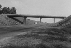
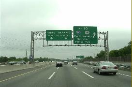
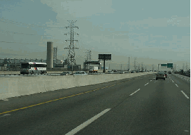
These 2000 photos show the southbound New Jersey Turnpike (I-95) at EXIT 10 (I-287 and NJ 440) in Metuchen (left photo) and EXIT 6 (I-276 / New Jersey Turnpike-Pennsylvania Extension) near Florence Township (right photo). (Photos by Jim K. Georges.) |
||
|
DO YOU BELIEVE IN MAGIC? During 2000, NJDOT activated the $45 million "MAGIC" intelligent transportation system along the New Jersey Turnpike and other North Jersey roadways. The "MAGIC" system, which stands for Metropolitan Area Guidance Information and Control, uses radar, pavement sensors, electronic message signs, fiber-optic cable and closed circuit cameras to alert drivers to traffic accidents or weather hazards, and to post the best alternate routes. |
||
|
NEW TOLLS, NEW PROJECTS: On September 30, 2000, the New Jersey Turnpike Authority implemented one of the first variable toll systems in the nation at all of the turnpike's toll plazas. The new EZ-Pass system uses variable demand pricing so that motorists using the turnpike during non-peak hours may do so at reduced rates. |
||
|
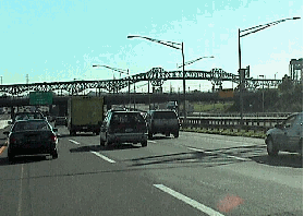
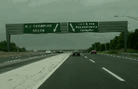
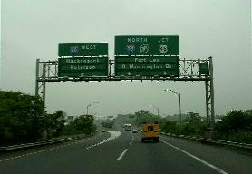
These 2000 photos show the northbound New Jersey Turnpike (I-95) near EXIT 13 (I-278) in Linden (left photo), and on the northbound western spur at EXIT 18W (US 46) in Ridgefield Park. (Photos by Jim K. Georges.) |
||
|
"The actual turnpike is asphalt. But there is the metaphysical turnpike going on in your brain." - Hank Stuever, The Washington Post |
||
|
THE TURNPIKE IN POPULAR CULTURE: In contemporary poetry and music, the New Jersey Turnpike was reflective of its times. In the 1950's, the Turnpike represented the efficiency and freedom brought by fast automobiles. These feelings were depicted in the Chuck Berry song "You Can't Catch Me," in which the singer decides to take his new Cadillac out for a ride on the New Jersey Turnpike. In the 1960's and 1970's, sentiment toward the turnpike turned negative, as the turnpike was represented as the spoiler of the environment and the cause of national malaise. This was best described in the line, "counting the cars on the New Jersey Turnpike, and they've all gone to look for America," written by Paul Simon and Art Garfunkel. By the 1980's, there was a coming to terms with the turnpike, as evidenced by songs written by Bruce Springsteen that have a nightmarish, survivalist vision of life in New Jersey. |
||
|
Michael Kotler summarized this vision in the nyc.transit newsgroup as follows: |
||
|
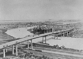
This postcard from the mid-1960's show the New Jersey Turnpike (I-95) looking north at the interchange for the Garden State Parkway in Woodbridge. Note that the turnpike was only six lanes wide at this time (it was widened from four lanes in 1955). Until 1966, there were separate exits for the Garden State Parkway (old EXIT 10) and US 9 (old EXIT 11). The construction of I-287 / NJ 440 and the quad-carriageway widening project changed this setup. (Postcard supplied by Rush Wickes.) |
||

|
THE TURNPIKE EXTENSION TO ROCKLAND COUNTY: Soon after the turnpike mainline was completed in 1952, the New Jersey Turnpike Authority, in conjunction with the New York State Thruway Authority, proposed a 13-mile extension of the mainline north through Bergen County into Rockland County. At its northern terminus, the proposed extension was to connect to the New York State Thruway mainline (I-87 and I-287). |
||
|
Construction of the extension was to provide a more direct bypass of the New York City area via the Tappan Zee Bridge to New England. The Bergen County section of the New Jersey Turnpike Extension was to be built by the New Jersey Turnpike Authority, while the Rockland County section was to be constructed by the New York State Thruway Authority. |
||

|
THE WHOLE TURNPIKE SHOULD BE I-95: From time to time, the topic of I-95 through the Delaware Valley appears in the misc.transport.road newsgroup. The following paragraphs reflect my opinion on this subject (with due credit to nycroads.com and phillyroads.com contributor Chris Blaney). |
||
|
However, the Federal Highway Administration (FHWA) raised the following objections to placing I-95 markers on the southern 51 miles of the New Jersey Turnpike: The most serious Federal problem is that the southern part of the New Jersey Turnpike is not presently on the Interstate System and must not carry an Interstate number. The state of New Jersey would have to be sure that all features are up to current standards, agree to operating requirements for Interstates, and submit a request to the FHWA that it be designated an Interstate. The state has not been persuaded so far that it would be worth it. As to changing route numbers, the FHWA and the American Association of State Highway and Transportation Officials (AASHTO) insist that all the states involved (New Jersey, Pennsylvania and Delaware) submit requests for an agreed-upon pattern of numbers. This is quite difficult for the states as there are always costs and motorist confusion to contend with. In addition, communities and businesses often defend "ownership" interests in retaining the present numbers. For the most part, the main route numbers go through cities, rather than around them. FURTHER EXPANSION: The ten-lane, dual-dual arrangement in northern New Jersey should be extended south to EXIT 6 (Pennsylvania Turnpike). Bridges built for the Hightstown Bypass (NJ 133) over the New Jersey Turnpike near EXIT 8 in East Windsor Township hint that such an expansion may take place in the near future. In addition, the turnpike should be widened to six lanes from the southern terminus north to EXIT 4 (NJ 73) in Mount Laurel Township. CHANGES FOR INTERCHANGES: The following new and relocated interchanges should be constructed along the New Jersey Turnpike:
|
||

|
SOURCES: "High Road from the Hudson to the Delaware" by Paul J. C. Friedlander, The New York Times (11/25/1951); "Built for Safety" by Armand Schwab, Jr., The New York Times (11/25/1951); "Report of a Drive Down the New Highway," The New York Times (11/25/1951); "Big Job in a Hurry" by Paul Heffernan, The New York Times (11/25/1951); "A Full Length Portrait of New Jersey" by John B. Ehrhradt, The New York Times (11/25/1951); "They Build Cars Faster Than Roads" by Armand Schwab, Jr., The New York Times (11/25/1951); "From Maine to Chicago Without a Traffic Light," The New York Times (11/25/1951); "City Linked to Superhighway" by Armand Schwab, Jr., The New York Times (1/20/1952); "Bypass in Bayonne" by Joseph C. Ingraham, The New York Times (9/09/1956); "Interesting Facts About the New Jersey Turnpike," New Jersey Turnpike Authority (1956); "Rockland County Transportation Study and Highway Plan," Rockland County Planning Department (1960); Transportation 1985: A Regional Plan, Tri-State Transportation Commission (1966); "Opening Interstate Route 95: Ridgefield Park and Teaneck, Bergen County," New Jersey Department of Transportation (1971); "Turnpike Widening: Final Environmental Impact Statement," New Jersey Turnpike Authority (1987); "Turnpike To Expand Interchange 7" by Robert J. Salgado, The New York Times (7/03/1988); Looking for America on the New Jersey Turnpike by Angus Kress Gillespie and Michael Aaron Rockland, Rutgers University Press (1989); "Sights, Sounds of a Turnpike Always in Motion" by Jeffrey Page, The Bergen Record (6/20/1999); "Renaming the Turnpike" by Sandra Earley, News 12-New Jersey (7/09/1999); "Plan for Two Increases Over Four Years Includes Big EZ-Pass Discounts" by P.L. Wyckoff, The Star-Ledger (11/19/1999); "Welcome to the New Jersey Turnpike," New Jersey Turnpike Authority (1999); "Turnpike Bonds Sold," The Trenton Times (4/07/2000); "Humanizing the Highway: The New Jersey Historical Society's New Jersey Turnpike Project" by Ellen M. Snyder-Grenier, National Trust for Historic Preservation (4/08/2000); "DOT's Electronic Signs Finally Get Their Smarts" by Pat R. Gilbert, The Bergen Record (6/22/2000); "EZ-Pass To Hit the Turnpike," WCBS-TV (9/11/2000); "New Jersey Turnpike: Image Help Ahead" by Bob Levey, The Washington Post (5/18/2001); "Turnpike Giving Builder $84 Million To Boost Secaucus Rail Project" by Pat R. Gilbert, The Bergen Record (7/12/2001); "What Exit?" by Hank Stuever, The Washington Post (8/05/2001); "Down Memory Lane" by Peter Genovese, The Star-Ledger (11/02/2001); "Turnpike Plans Would Cut Truck Traffic Clogging Carteret" by Paul Nelson, The Home News-Tribune (12/06/2001); "Much Faster EZ-Pass Lanes Are Planned at Seven Toll Plazas" by Ronald Smothers, The New York Times (10/31/2002); "Turnpike Exit Is One for the 'X' Files" by Pat R. Gilbert, The Bergen Record (5/06/2003); "Codey Wants 20 Miles of Pike Widened" by Joe Malinconico, The Star-Ledger (12/01/2004); "N.J. Looking into Selling Toll Roads To Get Cash" by Jennifer Moroz, The Philadelphia Inquirer (1/25/2005); "New NJ Turnpike Interchange Criticized," WINS-AM (11/28/2005); "Enter Exit 15X" by Shannon D. Harrington, The Bergen Record (11/30/2005); "Route 92 Plan Loses Funding" by Jonathan Tamari, The Asbury Park Press (11/30/2005); "Corzine: Turnpike Won't Go Private" by Kaitlin Gurney, Jennifer Moroz, and Elisa Ung, The Philadelphia Inquirer (2/22/2006); "In Toll-Road Talk, Visions of Easy Cash" by Jennifer Moroz, The Philadelphia Inquirer (4/05/2006); "Route 92 Project Canceled To Focus on Turnpike Widening," The Associated Press (12/01/2006); "$2.7 Billion NJ Turnpike Widening Project Begins" by David Giambusso, The Star-Ledger (7/02/2009); American Society of Civil Engineers; Federal Highway Administration; North Jersey Transportation Planning Authority; Chris Blaney; Phil Case; Frank Curcio; Greg Davidson; Hank Eisenstein; David Jackino; Jeff Kitsko; Michael G. Koerner; Michael Kotler; Mario Laurenti; Larry Lucchetti; Raymond C. Martin; Christopher G. Mason; Dan Moraseski; Mike Natale; Ira Smilovitz; Jeff Taylor; William F. Yurasko. |
||
|
NEW JERSEY TURNPIKE ROAD CONDITIONS: |
||

|
OFF-SITE EXIT LISTINGS: |
||
|
VIEW OR SUBMIT YOUR RATING TO RATETHEROADS.COM: |
||
|
|
||


|
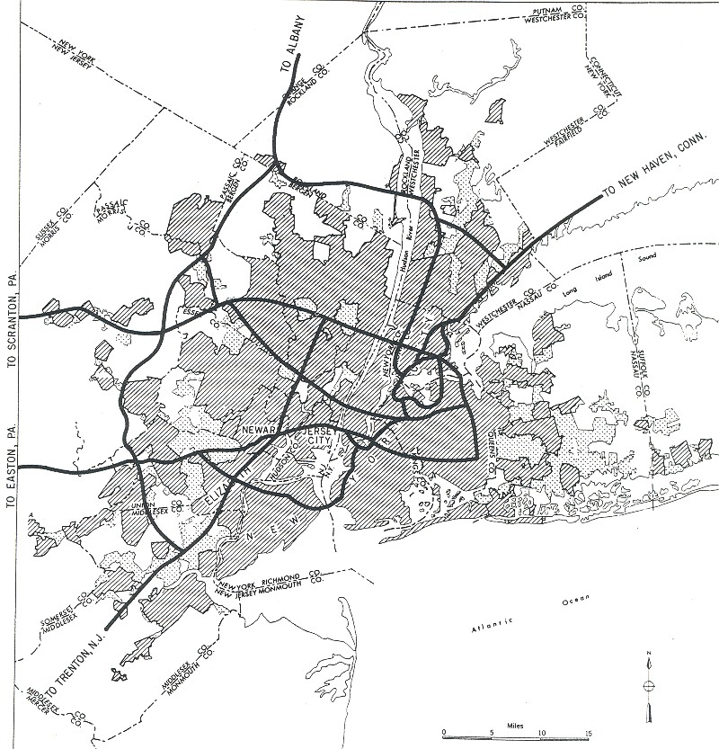
Back to The Roads of Metro New York home page. |
||

|
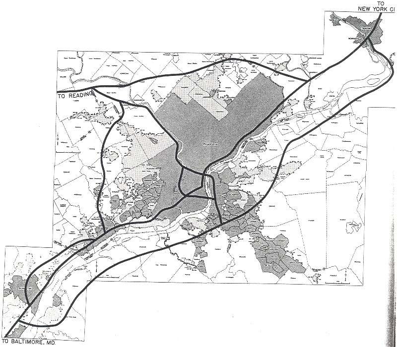
Back to The Roads of Metro Philadelphia home page. |
||
|
Site contents © by Eastern Roads. This is not an official site run by a government agency. Recommendations provided on this site are strictly those of the author and contributors, not of any government or corporate entity. |
||